

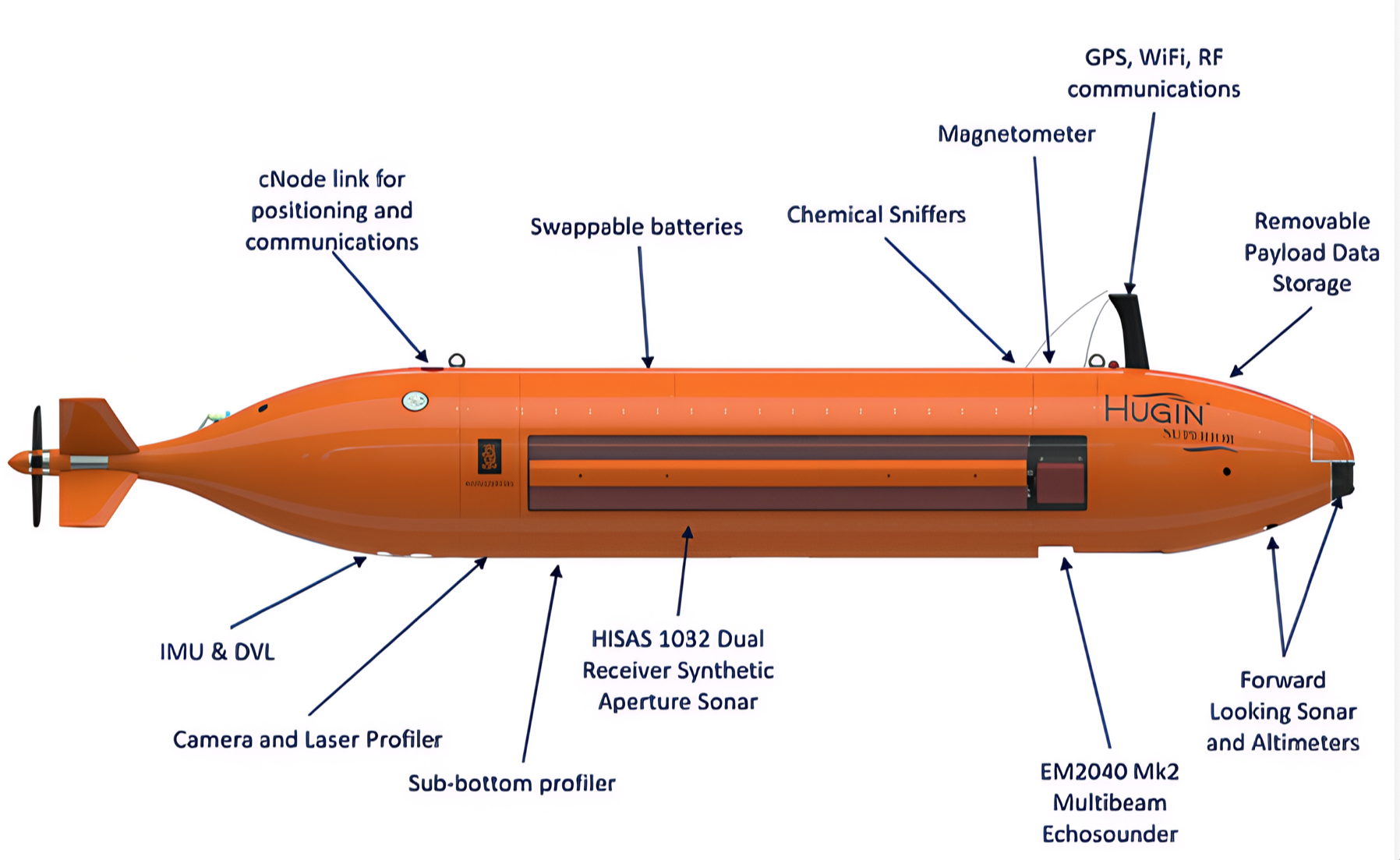
Blue Kite operates a dedicated Kongsberg HUGIN Superior — the most advanced autonomous underwater vehicle in commercial survey service. Managed and operated exclusively by Blue Kite, with full control of vehicle scheduling, mobilisation and deployment from our Singapore facility.
 k_Vd2ZHvyFpJ_Qr9.pdf
One vehicle, one dive — geophysical, visual, environmental and electromagnetic datasets acquired together, at depths most commercial fleets cannot reach.
Full-ocean-depth survey capability. Most commercial AUV fleets are limited to 3,000 m — the HUGIN Superior opens the deepest cable routes, mining prospects and geohazard surveys.
Stationed at our Singapore logistics and storage facility, delivering faster, lower-cost mobilisation across Southeast Asia and the Middle East than any Europe-based competitor.
Blue Kite controls the vehicle's calendar and movements. No third-party availability risk, no queuing for contractor equipment. Our team brings a wealth of hands-on experience operating and deploying HUGIN systems on survey campaigns worldwide.
Fitted as standard on our HUGIN Superior — a passive electrode and magnetometer system measuring electric and magnetic fields in seawater, acquiring simultaneously with the full sensor suite.
Full cathodic protection status and remaining-life estimation of pipelines with no physical contact or stabs. CP inspection at AUV survey speed — dramatically reducing survey time and HSE exposure, on exposed and buried lines.
Detects the magnetic field of active buried power cables, delivering accurate position and burial depth estimation without excavation or towed arrays.
Detection and delineation of seabed mineral deposits, including SMS anomalies — paired with the 6,000 m depth rating for deep-ocean exploration.
High-resolution geophysical site characterisation for energy developments.
Desktop to 6,000 m route survey, plus buried cable positioning and burial verification.
Geophysical, visual and contactless CP inspection in a single pass.
Full-ocean-depth mapping and electromagnetic delineation of seabed deposits.
CH₄, CO₂, O₂ and turbidity acquired alongside every survey.
Vehicle delivery
Arrival at Blue Kite's Singapore logistics and storage facility
Operational — first survey campaigns
Talk to us about your survey campaign — site survey, cable route, pipeline inspection, deep-sea exploration or environmental baseline.
Contact the Blue Kite team